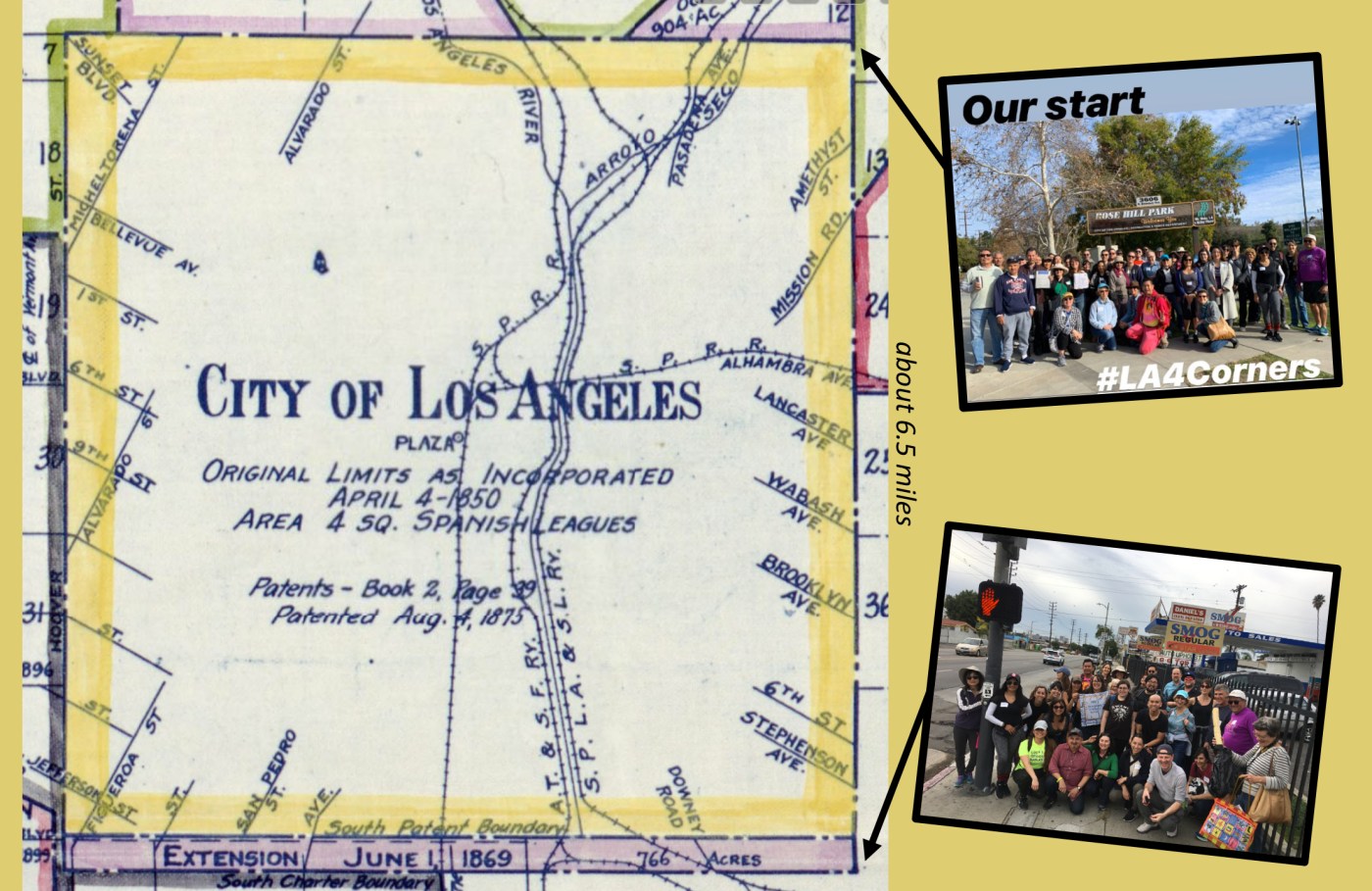
Through the support of Los Angeles Walks, I’ve been helping to organize a 4-walk series in which we’re making our way around the original border of the City of Los Angeles. This past weekend, about 50 people joined the trek down the eastern border which I co-lead with the amazing urban planner James Rojas.
For the last ten years, I’ve been wanting to walk Los Angeles’ original border, which is currently marked by plaques placed at each of LA’s original four corners. Back in the 1980s, the Los Angeles City Historical Society led the effort to establish these four plaques “to mark the four corners of the original Pueblo in a permanent and conspicuous manner.”

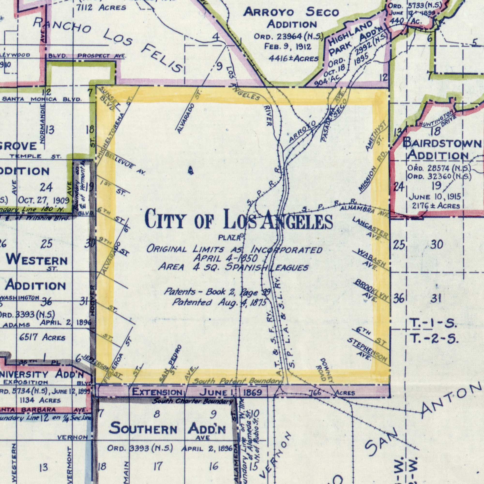
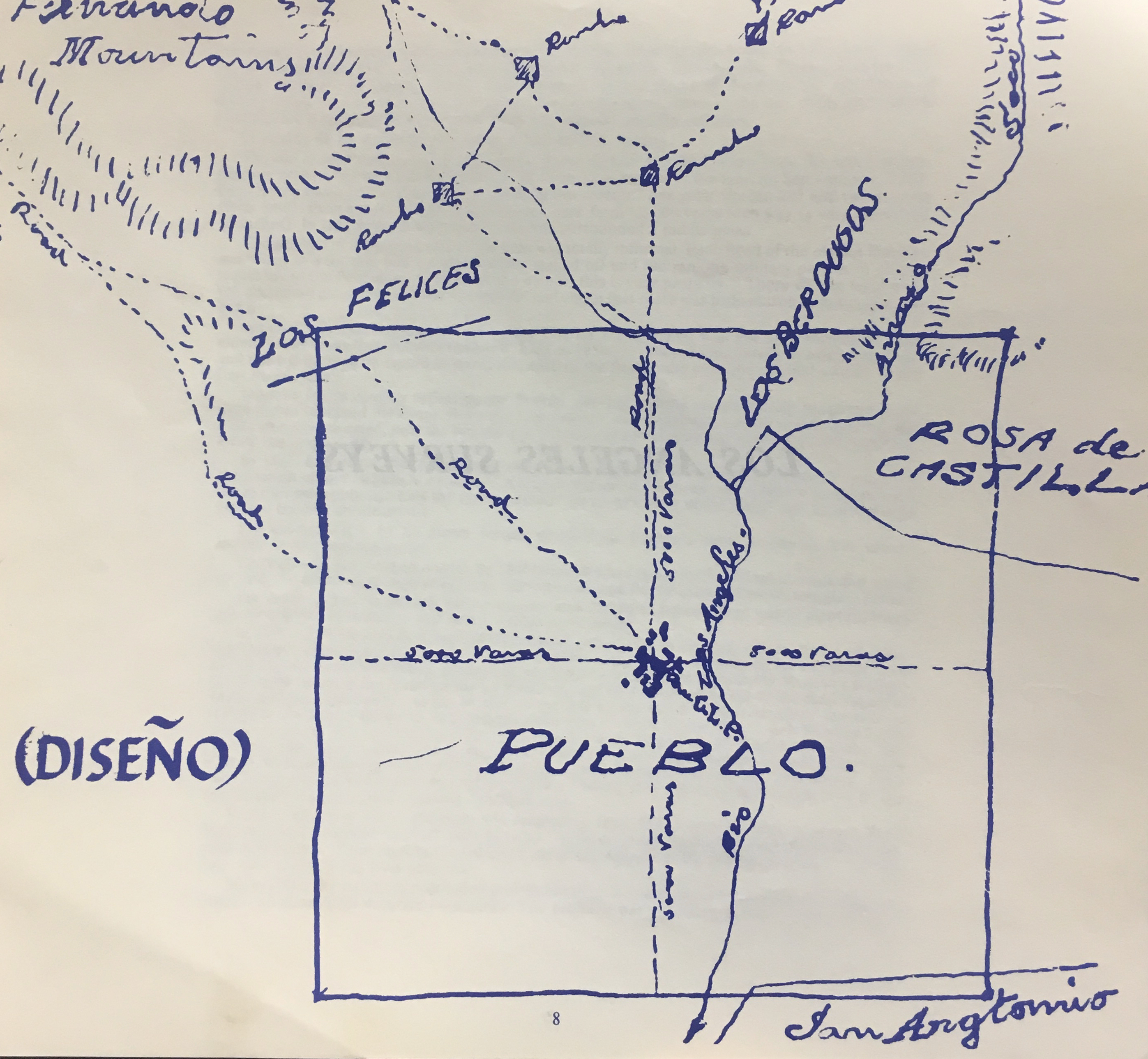
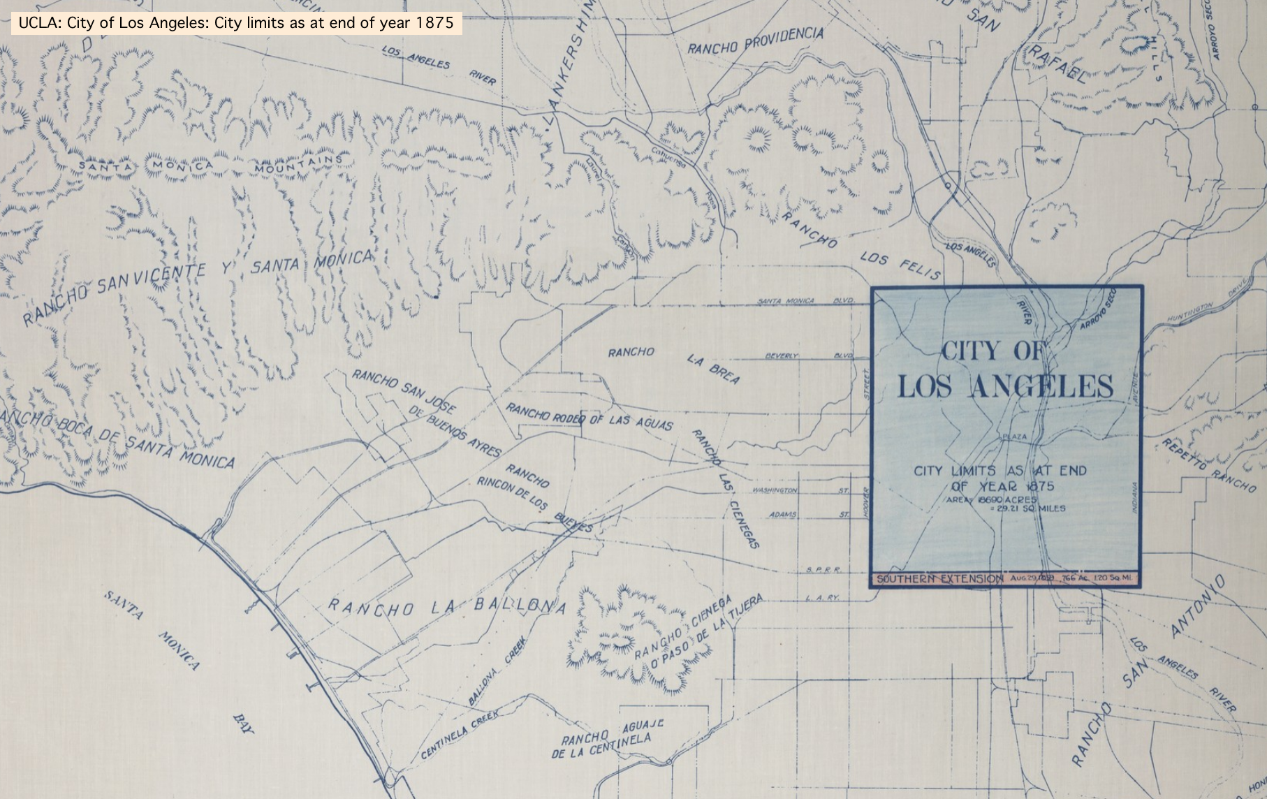
As we plan our fourth and last walk along the city’s northern border, here’s a cartographic glimpse at Los Angeles when it was still a square, long before it swallowed up nearby cities and swelled into the amoeba-like shape we know and (mostly) love.